| |
| Map Products |
| GPS Products |
| Projects |
| Community |
| Contact |
| Projects |
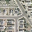
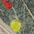
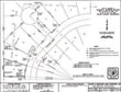
ArcGIS together with Image-Mapper produce the most powerful state of the art, internet ready, easy to use and expandable GIS mapping system in existence. This map making system displays layers of geographic information to produce comprehensive maps with an air-photo base with overlays including: land parcels, infrastructure, zoning, elevation contours and survey and other documents. Spatial information is presented seamlessly in addition to pop-up tables, legends, related descriptive documents, where applicable. The mapping system utilizes external information to enhance its information capacity by taking advantage of on-line databases to dramatically enhance the information content. |
What you see is a colorful air-photo base overlain with scale dependant GIS layers that turn on and off automatically as the user browses the map. The maps contain appropriate scale dependant labels for all features. The map has browsing tools that allow the user to position and scale the map to the desired location. Database search and printing always appear at the bottom of the screen. The print function contains scale bar, north arrow and disclaimer text. Geographic data can be effectively disseminated to and utilized by the general public using a combination of ArcGIS and Imagemapper internet map applications.
| NEW MAPS | ||
|
||